Copyright by P. Flament (1996)
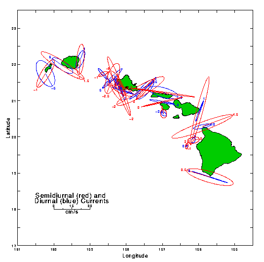
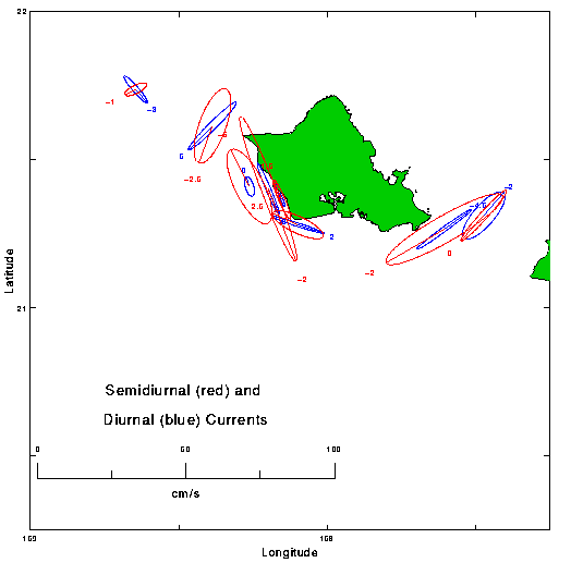
Plate 14. Measured tidal current ranges, at semi-diurnal (in red) and diurnal (in blue) periods. The major axes of the ellipses indicate the most probable orientation and strength of tidal currents; however because the phase of currents vary during the tidal cycle, it is not possible to predict how many hours after high water at Honolulu will currents be in the directions shown. Period: 1960 to 1995. Sources: University of Hawaii, Hawaii Institute of Geophysics; National Ocean Data Center, NOAA; Science Applications Internal Corporation. Units: cm/s.
Click to download EPS files of the plates.